- Contenidos:
- Coordenadas de Chuncheon
- Distancias a Chuncheon
- Accidentes geográficos
- Ciudades próximas a Chuncheon
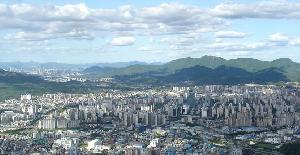
Aquí podrás obtener las coordenadas geográficas de Chuncheon, Corea del Sur, de manera sencilla, también te convertirmos las coordenadas en grados decimales para que puedas localidar Chuncheon, Corea del Sur, en Google Maps. La población de Chuncheon es de 209.746 habitantes.
Coordenadas geográficas de Chuncheon, Corea del Sur, en grados decimales:
- Longitud: 127.7341700
- Latitud: 37.8747200
Coordenadas geográficas de Chuncheon, Corea del Sur, en grados y minutos decimales:
- Longitud: E127°44'3.01"
- Latitud: N37°52'28.99"
Mapa de Chuncheon
Comparte a tus amigos


| Ciudad | Distancia | Coordenadas |
| Chuncheon | 0 Km | N37°52'28.99" E127°44'3.01" |
| Bongpyeong-myeon | 62 Km | N37°36'5.72" E128°20'54.1" |
| Yongpyeong-myeon | 68 Km | N37°37'37.78" E128°26'41.57" |
| Taehwa-myŏn | 74 Km | N37°30'17.82" E128°25'57" |
| Jinbu-myeon | 79 Km | N37°38'20.04" E128°35'6.97" |
| Pyeongchang-eup | 82 Km | N37°21'31.43" E128°24'3.35" |
| Sokcho | 84 Km | N38°12'25.24" E128°35'30.52" |
| Jumunjin-eup | 89 Km | N37°53'17.2" E128°45'0.72" |
| Suwon-si | 91 Km | N37°17'28" E127°0'32" |
| Mitan-myeon | 92 Km | N37°20'20.04" E128°31'27.84" |
| Bongdam-eup | 100 Km | N37°13'12.29" E126°57'6.59" |
| Inchon | 102 Km | N37°27'23.26" E126°42'18.54" |
| Ganghwa-gun | 111 Km | N37°44'49.99" E126°29'8.02" |
| Onyang-dong | 138 Km | N36°47'14.24" E126°59'3.98" |
| Cheongju-si | 139 Km | N36°38'13.99" E127°29'22.99" |
| Gaeun-eup | 140 Km | N36°38'36.1" E128°3'16.49" |
| Bongseong-myeon | 146 Km | N36°53'9.38" E128°49'13.3" |
| Sangun-myeon | 147 Km | N36°50'0.74" E128°45'19.4" |
| Seokpo-myeon | 148 Km | N37°2'41.24" E129°2'51.18" |
| Beopjeon-myeon | 149 Km | N36°54'27.47" E128°53'42.11" |
| Chunyang-myeon | 149 Km | N36°55'56.39" E128°55'48.18" |
| Hamchang-eup | 150 Km | N36°34'12.4" E128°10'46.38" |
| Socheon-myeon | 152 Km | N36°58'1.52" E129°0'57.42" |
| Myeongho-myeon | 153 Km | N36°51'31.36" E128°54'8.39" |
| Jaesan-myeon | 163 Km | N36°49'2.39" E129°0'46.01" |
| Hongsung | 170 Km | N36°36'3.24" E126°39'54" |
| Daejeon | 175 Km | N36°19'17" E127°25'10.99" |
| Subi-myŏn | 177 Km | N36°48'24.34" E129°13'0.41" |
| Apo-eup | 196 Km | N36°9'45.07" E128°15'7.52" |
| Gongsan-dong | 230 Km | N35°56'24" E128°38'20.72" |
Lo más destacado de Anyang, Corea del Sur
Anyang es un centro de transporte entre la capital, Seúl, y otras ciudades importantes del país. La ciudad está comunicada por las líneas 1 y 4 del metro de Seúl. Las ciudades vecinas de Anyang son Incheon y Gwangmyeong en el oeste y Suwon en el sureste. El antiguo centro de la ciudad está ubicado alrededor de la estación Anyang y forma...
10 curiosidades de Corea del Sur
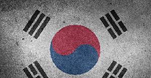
Yin (azul) es equivalente al frío y la oscuridad, mientras que yang (rojo) es un símbolo de calor y la luz. Alrededor del yin-yang hay 4 taeguk (uno cada 4 elementos: agua, aire, tierra y fuego). Las coordenadas de Corea del Sur son: 37°34′N 126°59′E. 2) Cómo calculan la edad Los coreanos tienen una forma totalmente diferente de...
- Chuncheon
- Bongpyeong-myeon
- Yongpyeong-myeon
- Taehwa-myŏn
- Jinbu-myeon
- Pyeongchang-eup
- Sokcho
- Jumunjin-eup
- Suwon-si
- Mitan-myeon
- Bongdam-eup
- Inchon
- Ganghwa-gun
- Onyang-dong
- Cheongju-si
- Gaeun-eup
- Bongseong-myeon
- Sangun-myeon
- Seokpo-myeon
- Beopjeon-myeon
- Chunyang-myeon
- Hamchang-eup
- Socheon-myeon
- Myeongho-myeon
- Jaesan-myeon
- Hongsung
- Daejeon
- Subi-myŏn
- Apo-eup
- Gongsan-dong
- Te puede interesar:
- Antípodas de Chuncheon
- Coordenadas de Corea del Sur
Comentarios
Copitzy bravo ha añadido el comentario.
Me gusto por k me ayuda a poder así mi tarea sin tener k navegar mucho por otras paginas